When Drones Need Higher Accuracy, When Is It Time to Move from Standard GNSS to High-Precision RTK?
When Drones Need Higher Accuracy, When Is It Time to Move from Standard GNSS to High-Precision RTK?
Blog Excerpt
As commercial drones move from basic waypoint flying into mapping, inspection, autonomy, and precision landing, standard GNSS often becomes the limiting factor. This guide explains when it makes sense to upgrade to RTK, what changes at the system level, and how the u-blox ZED-F9P platform helps turn a drone from a general navigation device into a centimeter-grade robotic instrument.
Why Standard GNSS Is Still Good Enough for Many Drones
For many drone programs, standard GNSS is still good enough. A recreational quadcopter filming wide-angle video, a low-risk UAV following simple waypoint paths, or a basic visual survey platform does not always need centimeter-level positioning. In those cases, adding RTK can look like unnecessary cost, unnecessary integration work, and unnecessary operational complexity.
But that logic breaks down quickly once the mission changes.
The moment a drone has to repeat the same route accurately, land precisely, generate engineering-grade maps, dock autonomously, inspect high-value infrastructure, or operate in dynamic and partially obstructed environments, standard GNSS often stops being a convenience and starts becoming a bottleneck. That bottleneck is not only about absolute accuracy. It is also about repeatability, drift, confidence, heading stability, and whether a mission can be trusted enough to scale. The upgrade path from standard GNSS to RTK is therefore not just a navigation decision. It is a system-architecture decision.
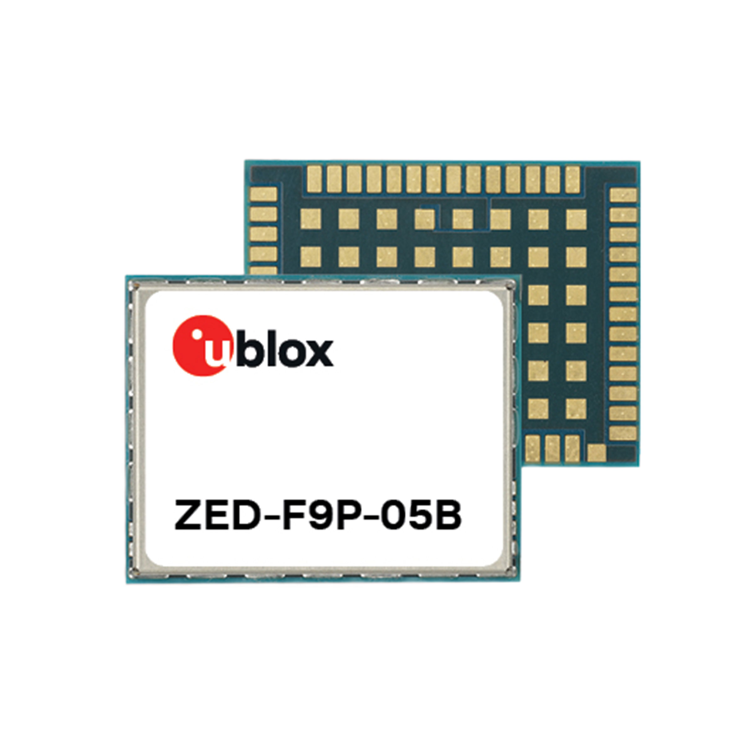
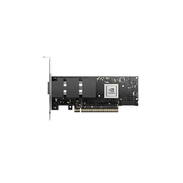
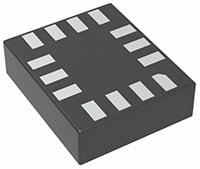
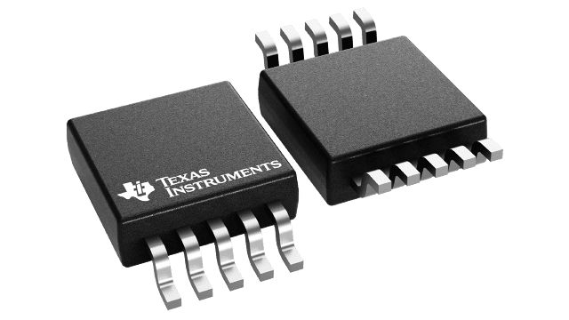
This is exactly where the u-blox ZED-F9P family becomes relevant. The ZED-F9P-05B is built on the u-blox F9 receiver platform and is explicitly positioned as a multi-band GNSS high-precision receiver for high-volume industrial applications. Its datasheet states support for integrated RTK and PPP-RTK technologies for centimeter-level accuracy in a compact 17.0 × 22.0 × 2.4 mm surface-mounted form factor.
That combination matters because it changes how a drone is designed and what jobs it can reliably perform. A standard GNSS drone can know roughly where it is. A high-precision RTK drone can know where it is with enough consistency to automate work that used to demand human supervision, excessive field correction, or heavy post-processing. That difference affects flight control confidence, payload productivity, mission economics, and eventually BOM decisions.
This article is not a generic RTK explainer and not a product brochure. It is a practical decision guide. The goal is to help hardware engineers, UAV architects, and procurement teams answer a real design question: when is standard GNSS still enough, and when does it make business and technical sense to move to high-precision RTK?
The Point Where Standard GNSS Starts to Become a Limitation
A useful RTK article should not start by pretending every drone needs RTK. That is not true, and engineers know it.
Standard GNSS still works well for a large class of UAV programs. If the drone’s job is broad-area navigation, simple waypoint following, general aerial imaging, or consumer-grade flight stabilization, meter-level positioning is often acceptable. Standard GNSS has the advantage of simplicity: no correction service, no extra infrastructure, lower hardware complexity, and a smaller integration burden.
This matters commercially. Many drone teams do not fail because they chose standard GNSS; they fail because they chose it for a mission category that had already outgrown it.

There are three reasons standard GNSS continues to survive in many UAV platforms:
First, it is easy to deploy. A standard module can often be integrated with minimal ecosystem requirements. No live correction stream, no base station planning, no PPP-RTK service subscription, no concern about correction continuity during flight.
Second, it is usually good enough for low-tolerance missions. If the drone is taking wide-angle promotional footage, conducting basic site overviews, or flying in an environment where meter-scale offsets do not matter, the value of RTK may not justify the design effort.
Third, it keeps the system simple. Low-complexity programs care about fast time to prototype, light software burden, and fewer dependencies. In such cases, a lower-precision navigation layer is a reasonable trade-off.
The problem is that teams often keep this architecture longer than they should. They add new mission promises—automatic docking, repeatable corridor inspection, survey-grade mapping, precision spraying, or moving-platform landing—while leaving the navigation stack in a standard GNSS mindset. That is usually where the operational pain begins.
The cleanest way to understand the GNSS-to-RTK upgrade threshold is to stop asking, “How accurate is my module?” and start asking, “How much navigation uncertainty can this mission tolerate?”
Standard GNSS becomes a limitation when uncertainty is no longer harmless.
That threshold usually appears in four places.

1. Repeatability becomes more important than rough location
In many UAV applications, absolute position is only part of the story. A drone that must fly the same route repeatedly over a powerline, inspect the same points on a bridge, or revisit the same crop rows needs path consistency. If the route shifts by one to three meters from mission to mission, the workflow becomes harder to trust. The issue is not that the drone gets lost. The issue is that repeated data becomes harder to compare, automated workflows become less reliable, and operators compensate with more manual intervention.
2. Vertical and lateral drift start to affect mission success
Standard GNSS drift can be acceptable for visual flights and unacceptable for precision work. If the UAV must approach a confined landing zone, align with a docking pad, keep a spray path aligned with crop geometry, or collect repeatable mapping data, a meter of drift is not a minor inconvenience. It is the difference between a scalable workflow and a supervised one.
3. Manual correction starts to dominate the workflow
A standard GNSS drone can still complete precision work if enough human correction is layered around it. Operators can place more ground control points, correct more data later, fly more overlap, accept more rework, or assign more pilot attention during landing and close-in maneuvering. But once the workflow depends on these compensations, standard GNSS is no longer really cheap. It is simply moving cost from hardware into labor, time, risk, and mission friction.
4. The mission is dynamic, autonomous, or regulated
RTK becomes much more relevant when the drone is expected to do more than “go somewhere.” The upgrade threshold sharpens in applications such as:
- autonomous landing
- moving-platform landing
- precision mapping
- low-tolerance spraying
- BVLOS and autonomy-oriented workflows
- heading-sensitive navigation
- infrastructure inspection in repeatable corridors
Once a drone program enters that class of mission, standard GNSS usually stops being the default smart choice. It becomes the limiting layer.
What RTK Actually Changes in Drone System Performance
A common mistake in RTK content is reducing the upgrade to one sentence: “RTK is more accurate.” That is true, but it is not enough to help a system architect.
RTK changes the behavior of the drone system, not just the position number on paper.
At the architecture level, RTK changes three things:
It changes confidence
A standard GNSS drone may be navigable. An RTK drone can become trustworthy enough for deterministic workflows. That difference affects how aggressively autonomy can be used, how much pilot correction remains in the loop, and whether data products can be treated as engineering assets rather than approximate visual outputs.
It changes workflow structure
When a drone carries RTK-grade positioning, teams can reduce some of the compensating steps required by less precise navigation. In mapping and surveying, this can mean fewer manual reference steps and a cleaner photogrammetry pipeline. In infrastructure inspection, it can mean faster repeat visits and more consistent data capture. In automated landing, it can reduce the operational burden of visual correction during the final descent.
It changes what is practical to automate
High-precision navigation makes new mission categories realistic. RTK is linked not just to generic precision, but to autonomous landing, moving platform docking, real-time BVLOS, and industrial workflows where position repeatability becomes part of safety and productivity.
This is why the standard GNSS → RTK step is best understood as a mission-enablement upgrade.

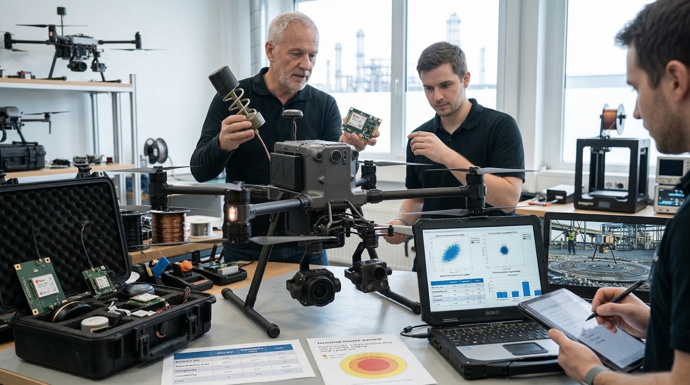
Where ZED-F9P Fits in the Drone Navigation Stack
The ZED-F9P should not be viewed as an isolated positioning chip. It is better understood as a high-precision navigation layer within a larger UAV stack.
In practical drone architectures, ZED-F9P sits between raw satellite signals and the higher-level autonomy or control logic that depends on precise position and heading data. The module supports multi-band GNSS and all four major constellations—GPS, GLONASS, Galileo, and BeiDou—plus SBAS and QZSS can contribute to a high-precision solution depending on configuration and corrections.
That matters because the navigation problem for drones is rarely single-dimensional. The UAV stack typically includes:
- flight controller
- IMU
- barometer
- compass or heading subsystem
- GNSS module
- telemetry or correction link
- companion computer for advanced missions
- post-processing or cloud workflow, depending on use case
The ZED-F9P platform upgrades this stack in several ways.

Multi-band precision improves robustness
Multi-band reception helps cancel ionospheric errors and speeds ambiguity resolution, improving convergence under foliage, multipath, or urban obstructions.
Moving base support changes heading and docking possibilities
This is one of the most powerful differentiators. The ZED-F9P-05B includes moving base support, enabling both base and rover to move while computing their relative position. u-blox explicitly ties this to follow-me, moving-platform landing, and attitude sensing, making the module relevant not just for mapping drones but for more advanced autonomy scenarios.
PPP-RTK and correction-service options make scaling easier
Not every UAV operator wants to manage local tripod bases or fixed radio infrastructure. This is part of what makes the ZED-F9P family more scalable for distributed, enterprise-grade drone deployments.
Compact integration supports SWaP-sensitive designs
The module’s 17.0 × 22.0 × 2.4 mm footprint directly supports UAV system integration in airframes where weight, board area, and thermal discipline matter.
Multiple interfaces simplify system design choices
The module supports UART, SPI, I2C, and USB interfaces, which means it can be integrated flexibly into different autopilot and companion-computer architectures.
In short, ZED-F9P fits not as a luxury add-on, but as the precision layer that allows an industrial UAV stack to move from good enough navigation to automation-ready positioning.
Similar u-blox Models Related to ZED-F9P-05B
When evaluating the ZED-F9P-05B, it is also useful to look at several closely related u-blox products that sit within the same high-precision positioning ecosystem. These models help show that ZED-F9P is not just a single standalone part number, but part of a broader u-blox F9 high-precision GNSS solution path.
ZED-F9P-15B
The ZED-F9P-15B is one of the closest official references to the ZED-F9P-05B because it belongs to the same ZED-F9P family. For engineering teams comparing lifecycle options or product-family continuity, it is one of the most relevant same-series models to review.
ZED-F9P-04B
The ZED-F9P-04B is another official ZED-F9P series variant. It is useful as a family-level comparison point because it reflects the same broader high-precision GNSS and RTK positioning direction as the 05B, even if it represents an earlier commercial version.
ZED-F9P-02B
The ZED-F9P-02B is also part of the official ZED-F9P module family. Including it in the discussion helps readers understand that ZED-F9P has evolved through multiple official versions, which is important when reviewing historical design choices, legacy references, or family-level sourcing discussions.
NEO-F9P
The NEO-F9P sits within u-blox’s broader F9 high-precision positioning platform and is one of the most relevant related products outside the exact ZED-F9P package line. It is particularly useful when discussing how u-blox addresses high-precision GNSS / RTK needs across different module formats.
ZED-F9R
The ZED-F9R is not a direct same-series replacement for the ZED-F9P, but it is still highly relevant because it belongs to u-blox’s F9 high-precision positioning family and adds dead reckoning capabilities. For readers exploring broader high-precision navigation strategies, it represents an adjacent solution path worth noting.
Drone Application Scenarios That Benefit Most from RTK
Not every UAV should upgrade. But some clearly should.
1. Surveying and mapping drones
If the drone is expected to generate accurate orthomosaics, corridor maps, terrain models, or construction progress captures, standard GNSS quickly becomes limiting. RTK reduces spatial uncertainty and helps the payload deliver data products that can support engineering decisions, not just visual inspection.
2. Industrial inspection drones
Inspection programs gain value from repeatability. A powerline drone, bridge inspection drone, or solar-site UAV benefits when it can revisit the same coordinates and viewing geometry with much tighter consistency.
3. Precision agriculture drones
Agricultural UAVs benefit from path consistency and edge control. In spraying, row-following, or repeat imaging, the difference between meter-level drift and centimeter-level consistency can affect input placement, overlap discipline, and data usefulness.
4. Autonomous docking and charging
A drone that returns to a charging dock or service pad needs far more than rough navigation. Standard GNSS may get the aircraft near the right zone. RTK-grade positioning helps close the tolerance gap necessary for repeatable autonomous docking.
5. Moving-platform operations
This is where ZED-F9P becomes especially distinctive. Relative high-precision vector computation is exactly what turns moving-base landing and tracking from a research demo into a practical system.
6. Heading-sensitive and compass-challenged systems
Moving-base support also enables relative heading and attitude uses that reduce dependence on magnetic compass behavior. In magnetically noisy or structurally complex platforms, that can be a major system-level advantage.
How to Decide Whether a Drone Program Should Upgrade
A practical upgrade decision should not begin with the module. It should begin with the mission.
A drone program usually should move from standard GNSS to high-precision RTK when most of the following become true:
- the mission needs sub-meter repeatability, not just approximate routing
- the payload is valuable enough that navigation uncertainty creates mission or safety risk
- the workflow depends on revisiting the same geometry consistently
- precision landing or docking is part of the roadmap
- the business model depends on data quality, not just visual output
- manual correction effort is becoming more expensive than hardware upgrade effort
- the team is already discussing autonomy, BVLOS, repeatable mapping, or moving-base operations
A program probably does not need RTK if it remains in low-risk visual flight, wide-tolerance imaging, or simple waypoint work.
Design-In and Sourcing Considerations
Once a team decides RTK is justified, the discussion changes from “Should we upgrade?” to “What exactly should we design in?”
That is where the ZED-F9P platform becomes commercially relevant.
The ZED-F9P family includes multiple variants, and that family view matters because procurement and engineering do not always want a generic answer. They want to know which variant fits which BOM strategy.
At design-in level, teams should think about:
- module footprint and board placement
- antenna strategy
- correction source strategy
- interface selection
- moving-base requirements
- raw-data logging and PPK fallback
- future firmware/security expectations
- whether the product roadmap may later need BVLOS or higher-trust positioning integrity
This is also where sourcing begins to matter. Once a ZED-F9P-class solution is chosen and enters the architecture, it stops being a research topic and becomes a BOM dependency. That is exactly why application articles like this can influence future RFQ behavior on a components platform.
Conclusion
The shift from standard GNSS to RTK is not something every drone program needs. But for industrial UAVs, mapping platforms, autonomous landing systems, repeatable inspection workflows, and moving-base operations, the upgrade eventually stops being optional.
That moment usually arrives when the mission can no longer tolerate drift, inconsistency, manual correction overhead, or weak docking precision. At that point, RTK is not just a better position estimate. It is a workflow and architecture upgrade.
The u-blox ZED-F9P family sits directly at that upgrade point. The ZED-F9P-05B combines multi-band GNSS, RTK / PPP-RTK, moving base support, compact integration, and the interface flexibility needed to fit real UAV systems. Its documented support for follow-me, moving-platform landing, and attitude sensing makes it especially relevant for advanced drone programs that need more than better GPS.
For engineering teams, the question is not whether RTK is impressive. The real question is whether the mission has already reached the point where standard GNSS is holding the platform back. When that answer becomes yes, ZED-F9P moves from interesting option to serious design-in candidate.
Mandatory Table 1: Standard GNSS vs. PPK vs. RTK
| Feature / Metric | Standard GNSS (L1 / basic) | PPK (Post-Processed Kinematic) | RTK (Real-Time Kinematic) |
|---|---|---|---|
| Typical Accuracy | 1.0–3.0 m | 1–3 cm | 1–3 cm |
| Correction Timing | None | Post-flight processing | Real time during flight |
| Real-Time Connectivity Requirement | None | None during flight | Yes, continuous correction link or service |
| Hardware Complexity | Low | Medium | High |
| Infrastructure Needed | None | Base station log or CORS data | Local base, NTRIP, or PPP-RTK correction service |
| Repeatability | Low to moderate | High after processing | High in live operation |
| Best Fit | Recreational flight, basic waypoint navigation | High-precision surveying, offline mapping | Autonomous landing, moving platform docking, real-time industrial UAV workflows |
| ZED-F9P Relevance | Fallback / non-RTK use | Raw carrier logging supports PPK fallback | Native high-precision operating mode |
Mandatory Table 2: ZED-F9P Feature-to-Value Mapping
| ZED-F9P Platform Feature | Engineering / System-Level Value | UAV Application Benefit |
|---|---|---|
| Multi-band GNSS | Better ambiguity resolution and multipath resilience | Faster convergence and better performance near structures, foliage, or reflective environments |
| RTK and PPP-RTK support | Centimeter-grade positioning with different correction architectures | Supports mapping, inspection, precision navigation, and scalable fleet operations |
| Moving base support | Computes accurate relative vector between moving antennas | Enables moving-platform landing, follow-me, and relative heading / attitude use cases |
| Compact 17.0 × 22.0 × 2.4 mm module size | Easier integration into SWaP-sensitive UAV boards | Suitable for embedded drone designs where footprint matters |
| Multiple interfaces (UART, SPI, I2C, USB) | Flexible integration into autopilot and companion-computer stacks | Simplifies architecture decisions for diverse UAV platforms |
| Raw carrier-phase capability / precision workflows | Supports PPK fallback and resilient survey pipelines | Protects mission value when live correction continuity is not guaranteed |
| High dynamic / update performance | Better responsiveness in dynamic motion | Improves navigation stability in fast or maneuvering UAV missions |
| Security evolution on newer variants | Higher trust positioning for advanced deployments | Stronger case for BVLOS, public safety, and critical operations |
Mandatory Chart 1
Industrial Inspection ROI Comparison
Chart Type: Clustered bar chart
Suggested Data
| Workflow Metric | Traditional Inspection | RTK Drone Inspection |
|---|---|---|
| Average Site Time (hours) | 8.0 | 2.5 |
| Relative Labor Requirement | 100 | 40 |
| Repeat Visit Likelihood | 70 | 25 |
| Relative Safety Exposure | 100 | 35 |
| Relative Data Consistency Score | 55 | 90 |
Mandatory Chart 2
Positional Drift Over Time: Standard GNSS vs. RTK Stability
Chart Type: Two-line technical comparison chart
Suggested Data
| Time Window | Standard GNSS Deviation (m) | RTK Deviation (m) |
|---|---|---|
| T1 | 1.2 | 0.03 |
| T2 | 2.1 | 0.02 |
| T3 | 0.9 | 0.03 |
| T4 | 2.8 | 0.02 |
| T5 | 1.7 | 0.03 |
| T6 | 3.0 | 0.02 |
FAQ
Does every drone need RTK?
No. Standard GNSS is still sufficient for many low-risk, wide-tolerance drone missions such as basic waypoint navigation and recreational imaging. RTK becomes important when repeatability, landing precision, engineering-grade mapping, or autonomy thresholds are involved.
What is the biggest difference between standard GNSS and RTK in drone operations?
The biggest practical difference is not just a better position number. RTK changes consistency, repeatability, landing precision, mapping trust, and workflow automation potential.
Why is moving base support such a big deal for UAVs?
Because it enables high-precision relative positioning between moving antennas. That supports advanced scenarios like follow-me, moving-platform landing, and attitude / heading determination.
What happens if the RTK correction link drops during flight?
That is one reason PPK fallback and raw data logging matter. High-value UAV programs need a strategy for precision resilience, not just peak performance.
Why would an engineer choose ZED-F9P instead of staying with a standard GNSS module?
Because some missions eventually outgrow meter-level navigation. If the program needs centimeter-level mapping, autonomous precision landing, moving-base heading, or scalable correction-service integration, the ZED-F9P family becomes a much stronger architectural fit.
Soft CTA
If a drone program is moving from basic navigation into mapping, inspection, autonomy, or precision landing, this is the right moment to evaluate whether standard GNSS is still enough. For teams considering a design-in path around the u-blox ZED-F9P family, a sourcing and RFQ discussion becomes relevant once the technical threshold is clear.
On icallin.com, that next step can include reviewing module options, comparing variant fit, and starting an RFQ process for the high-precision GNSS components needed to move from concept into BOM-ready execution.
Recommended Internal Links
If your team is evaluating high-precision drone navigation upgrades or considering the ZED-F9P family for design-in, these pages may help:
-
View the u-blox ZED-F9P-05B product page
Review the specific ZED-F9P-05B module page when comparing RTK-ready GNSS options for mapping, inspection, autonomous landing, or moving-base UAV projects. -
Browse more u-blox products
Explore the broader u-blox portfolio for GNSS, positioning, and wireless solutions that may fit different drone architecture requirements. -
Explore the full u-blox manufacturer page for related navigation options
Use the manufacturer page as a starting point for wider component evaluation if your UAV platform needs additional navigation, communication, or positioning modules.

Top Recommended part